Useful information
Drivers needed to know where a vacant space was, not simply whether a car park had spare capacity. Facility teams needed a current spatial view they could use operationally.

Zambeel developed a low-infrastructure parking technology stack that progressed from standalone wireless bay sensors to computer vision, geolocation, operator tools and outdoor driver guidance.
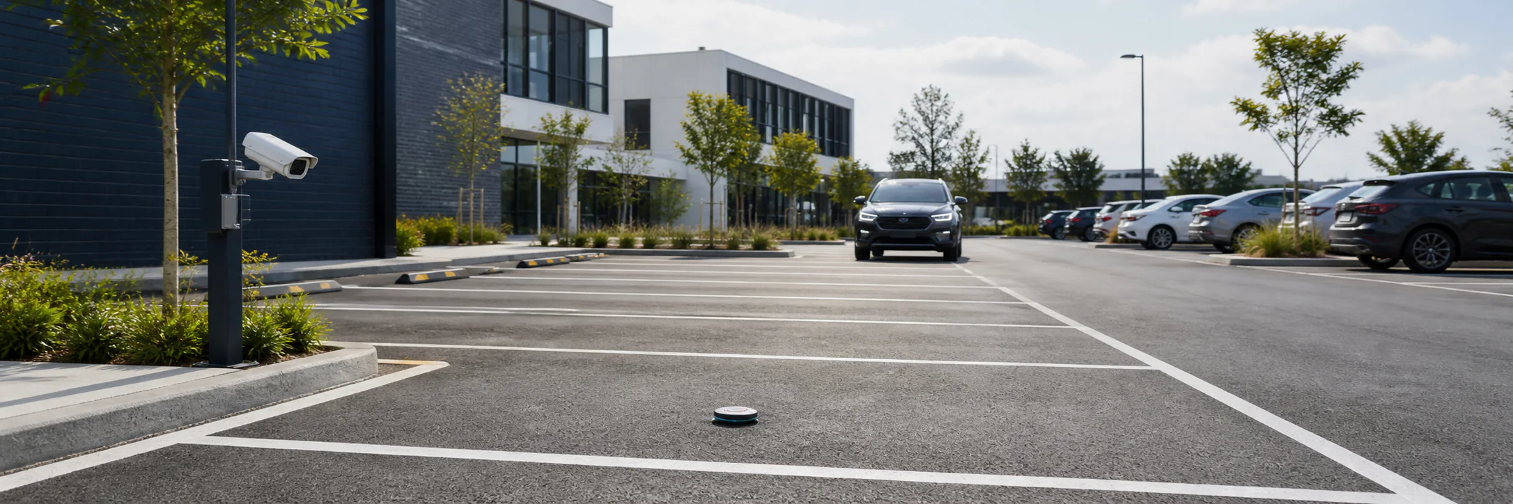
Zambeel originated and developed the technology from field sensing through vision, spatial software and a licensable operating platform.
How engagements workThe challenge
Many parking-occupancy systems place a powered sensor at every bay. At useful scale, wiring, civil work and the cost of each installed point can become more significant than the sensing technology itself.
Drivers needed to know where a vacant space was, not simply whether a car park had spare capacity. Facility teams needed a current spatial view they could use operationally.
The system needed to avoid extensive wiring and remain viable across existing outdoor parking areas that had not been designed around smart infrastructure.
Hardware path
The first development path used a standalone wireless unit at each space. A very-low-energy sensor watched for change. A more capable radar sensor was activated only when that change needed to be verified.
Keeping the higher-power sensor dormant for most of the operating cycle preserved the accuracy benefit of radar without the continuous battery consumption it would otherwise require.
The sensing and communication architecture avoided power and data wiring at each bay, with the field units reporting occupancy to the parking service.
The field deployment demonstrated real-time, bay-level vacancy monitoring using self-contained wireless sensors, without power wiring or civil modifications at each space.
Vision evolution
The project shifted toward scene-level computer vision when segmentation and contextual methods became capable enough to classify spaces from a wider view. Development then moved from a sensor at each bay to a connected platform built around cameras, cloud processing and spatial software.
Initial trials used cameras selected and positioned for the task. Current development can also work from suitable existing CCTV views.
Current frames are transmitted for server-side processing, allowing the model and management tools to develop without replacing field compute.
Camera location and learned scene understanding estimate the position of each space, with human-supervised training refining placement during onboarding.
Zambeel built graphical tools for onboarding lots, reviewing detections and managing the platform across its spatial and technical layers.
Validation
A 30-day evaluation covered 55 parking spaces. System classifications for each bay were compared with a human-annotated reference dataset drawn from images captured every 30 seconds.
Across all bay-level decisions in the study, the system assigned the correct vacant-or-occupied status 84% of the time. This established a measured starting point for subsequent dataset and model improvements.
The study confirmed that the approach could work and identified where additional data and model refinement were needed.
Current pilots are designed to compare parking-search time and reported convenience between drivers using the guidance service and those finding spaces without it.
Deployment model
The platform combines field capture, vacancy classification, verified map positions, outdoor guidance and administrative control. Parking solution providers can use the components under licence within their own customer offering.
The platform is being piloted with parking solution companies in North America, the UK and Asia.
The system uses low-resolution views that do not allow faces, vehicle number plates or other personal information to be identified. Images are processed without retaining an image history.
Development currently focuses on outdoor parking areas. Performance with existing CCTV and the benefit to drivers are being evaluated before the platform is offered at more locations and to more drivers.
What changed
The sensor development proved that a self-contained parking detector could operate for months without wired infrastructure and identified the practical factors that mattered to field reliability.
The vision platform changed the economics and reach of the proposition by allowing one view to cover many spaces and by making use of cameras already present at a site.
Mapping, onboarding and driver guidance turned occupancy detection into an operational service. The current pilots are now testing whether this service materially reduces search time and frustration.
Capabilities involved
Developing the platform required Zambeel to move between low-power electronics, field deployment, model development, mapping interfaces, cloud operations and pilot deployment without separating them into disconnected technical exercises.
Dataset collection, occupancy classification, scene understanding, camera integration and cloud inference.
ExploreLow-power sensing, radar verification, communications, battery architecture and field-ready assemblies.
ExploreGIS-style onboarding, parking maps, driver guidance, administrative tools and deployment infrastructure.
ExploreInstrumented field pilots, uptime analysis, labelled vision studies and benefit-measurement design.
ExploreRelated work
We can help determine the right combination of sensing, vision, connected hardware, software and field evidence.